Client: AWA Environmental and Wellington Water Ltd
Water utilities require detailed land cover mapping in order to support long term planning and make effective asset management decisions. Wellington Water and their partner AWA Environmental asked Lynker Analytics to use deep learning to generate high resolution impervious surface GIS data for Upper Hutt City and Lower Hutt City.
Our team has also undertaken impervious surface mapping from vertical aerial photography using our models in Auckland, Tauranga, Gisborne and Kapiti.
AWA Environmental Ltd offer pioneering computer-based mathematical modelling tools to support a range of infrastructure planning needs from flood mitigation and environmental compliance to spatial planning and asset management. These models greatly benefit from detailed land cover information.
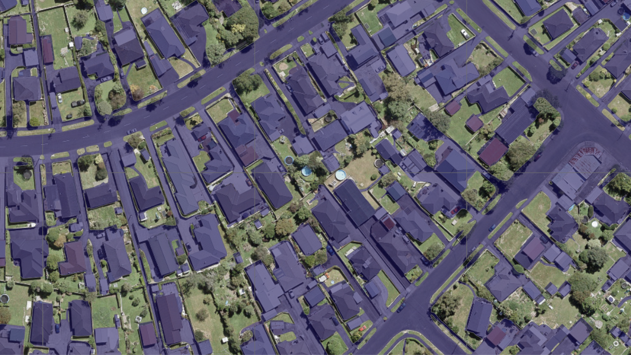
Using our Active Learning framework and annotation libraries we trained convolutional neural network models to infer the composite impervious surface from high resolution aerial ortho-photography. We considered the impervious surface to consist of the following: roads, footpaths, bridges, driveways, carparks, industrial land, other (including concrete and other materials adjacent to built structures). An example is shown below.

Our Active Learning frameworks ensured we captured only the most useful and informative impervious feature examples needed to train the models. The inference results (raster images) were then vectorised to produce polygons for review and validation. This can be a time-consuming part of the process but we have been successfully using automated targeted exception management processes based on the properties of the geometries that greatly reduce human review workloads.
The inference results exceeded initial expectations in the speed of capture and in the ability to make contextual inference of features beyond whats possible using traditional remote sensing techniques.

For example, our neural networks correctly identify surfaces occluded by trees by understanding the context in the image. In the example shown here the neural network has correctly inferred the existence of the driveway beneath the tree canopy. In other cases where the canopy is more dense the pervious surface is prioritised over the continuity of the underlying artificial surface.
The detailed raster and polygon data and inherent spatial statistics generated using this approach are highly effective to monitor the built environment.

The annotations we have built up are now very well matched to the built surface and vegetation profile common in New Zealand towns and cities while our models can be tuned to the domain specific decision rules needed to deal with different surface emphasis settings.
The final spatial data, as shown here, are visually interesting and can be used to inform hydrological imperviousness and hydraulic roughness for overland flow for stormwater models.
Deliverables:
- Raster impervious surface image
- Polygon feature data set describing impervious surface
- Data Quality and Accuracy report